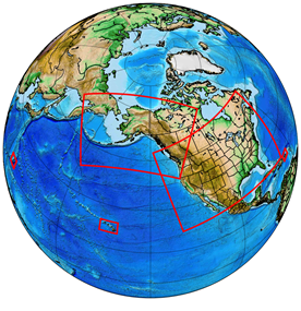
The two-dimensional Real Time Mesoscale Analysis (RTMA), UnRestricted Mesoscale Analysis (URMA), and the Precipitation Analysis package were upgraded and implemented into operations on the Weather and Climate Operational Supercomputing System (WCOSS) on July 28th, 2020 at 1200 UTC.
This upgrade includes a number of upgrades developed in coordination with stakeholders, which include the National Blend of Models, Weather Forecast Offices and NWS regions, NCEP service centers, and the FAA. Highlights of the upgrade include:
RTMA/URMA
- Introducing similarity theory calculations in the forward operator for the assimilation of near-surface winds to account for non-standard anemometer heights associated with mesonet observations.
- Extending the significant wave height analysis to the Great Lakes and Guam.
- Re-tuning the sky cover analysis to ensure consistency with the ceiling analysis, introduce quality control at night when satellite observations are of lower quality, and refine data thinning and decorrelation lengths to produce a more consistent analysis.
- Added new temperature downscaling for Guam (HiresW Smartinit), Hawaii and Puerto Rico (NAM Smartinit).
- Added new wind downscaling for CONUS and Alaska (HRRR Smartinit).
- Doubled the resolution of the Puerto Rico grid from 2.5 km to 1.25 km for consistency with the National Digital Forecast Database.
Precipitation Analysis
- Discontinuation of the legacy Stage II precipitation analysis.
- Using radar-only Multi-Radar Multi-Sensor QPE instead of first-run Stage II/IV for precipitation RTMA.
- Adding 6h/24h snowfall analysis from the National Operational Hydrologic Remote Sensing Center (NOHRSC) to the precipitation URMA system.
- Improved CONUS offshore precipitation analysis through the addition of a Whittaker blending function to seamlessly merge precipitation datasets.
- Changed Stage IV precipitation analysis product from GRIB1 to GRIB2.
Advancing from Two to Three Dimensions
The RTMA suite first went operational 14 years ago, in 2006, and since then it has undergone numerous changes and upgrades in its role as the analysis of record. This most recent implementation is the last of the two-dimensional era. The development of a fully three-dimensional system is underway. Extending the RTMA/URMA to three dimensions allows for the creation of highly useful nowcasting and situational awareness products, including full-column representation of standard meteorological fields such as temperature, water vapor, and wind, as well as hydrometeors (i.e., clouds, precipitation of all forms). Analysis updates will be performed at sub-hourly intervals, at least every 15 minutes, with low product latency. The 3D RTMA/URMA development effort is a collaborative project between NOAA’s NWS and OAR, and is a part of the UFS-R2O project.
